
Applies to:
Civil 3D
Issue:
Need to bring in USGS Lidar data to Civil 3D through ReCap
Causes:
Lidar data is tough to work with and ReCap is unfamiliar
Solution:
Download .laz or .las file from USGS site.
Open downloaded file in notepad and look for coordinate system in top few lines.
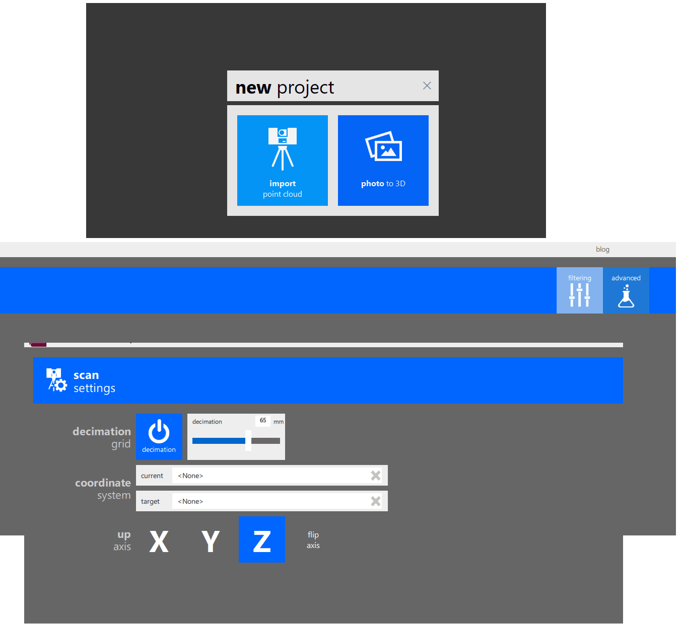
Open ReCap
Click 'New Project' in upper right
Click 'Import Point ClLoud', name project and select destination folder.
Click 'Advanced' in upper middle of screen.
Enter current coordinate system from notepad and destination coordinate system.
Click 'Import Files' in lower right.
Click 'Process Scans' in lower right.
Click 'Launch Project' in Lower right.
When processed click 'Automatic Ground Classification'.
Save .RCP Files
Open Civil 3D
Set Coordinate sytem to same as destination in ReCap
Type 'POINTCLOUDATTACH' and browse to RCP File
Do Not check 'Use Geographic location'.
Attach
Select point cloud and select 'Colors' in contextual ribbon and select Classification' to seperate Ground from other points.
Type MAPCREATEPCSURFACE, select surface, click 'Filter' in lower left of dialog box, select path to save tif file, set 'Level of Detail' to simplify a large surface and run surface.
Make sure coordinate system is set. Go to Toolspace > Surfaces > Create Surface from DEM
Browse to tif file saved in previous step. Create Surface.
To smooth and simplify surface:
Select Surface and select 'Extract Objects from Surface' in contextual ribbon.
Select Contours and Run.
Erase old surfcae and create new one from contours.


