
When using GIS type of data, it is possible to stylize (theme) the features to match a preferred color scheme. GIS data files can contain geometric features such as Points, Lines or Polygons along with attached intelligent attributes.
For the purposes of this post, the Town of Apex “zoning” data file (.shp) will be used. The AutoCAD Map 3D toolset has a great function where it will automatically randomize a color to connected data. Notice below how the connections to the polygon zoning features default to different colors in each new drawing: green, blue and purple. 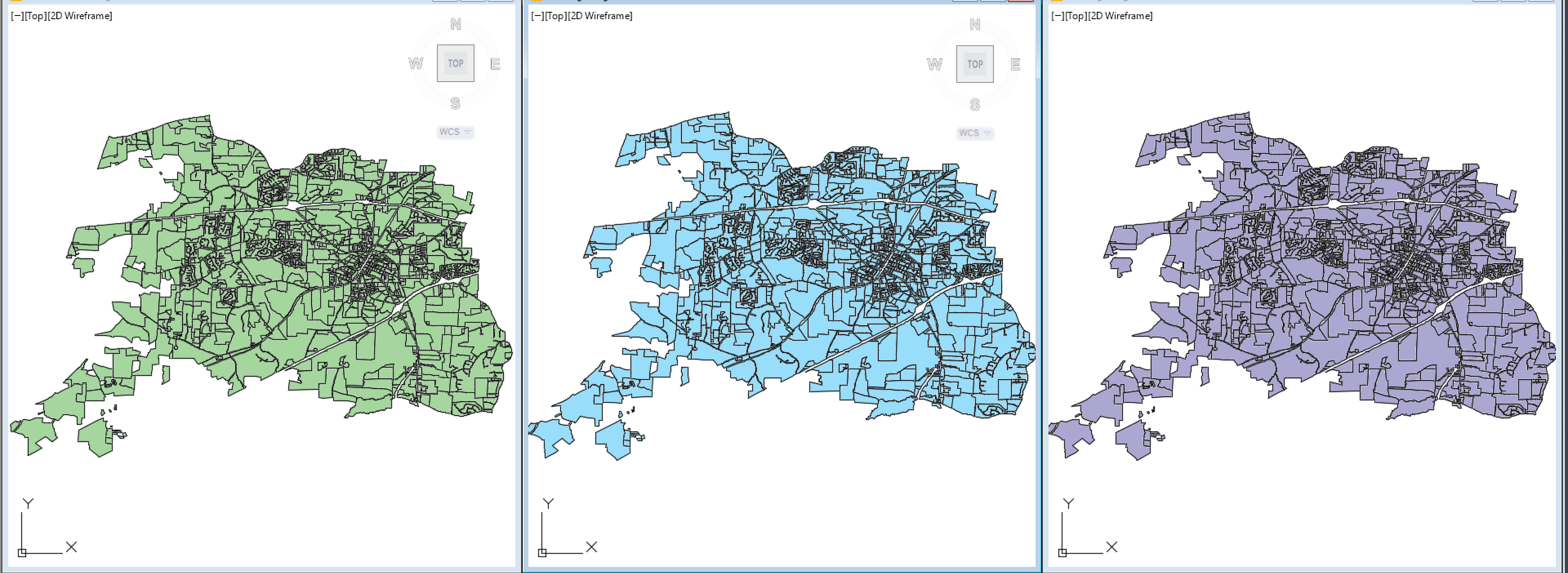
The built-in Map 3D color selection will create a different default look when connecting to data across multiple drawings or if multiple users connect to the same GIS features. A helpful function causing features to look different instead of all being bland and monotone.
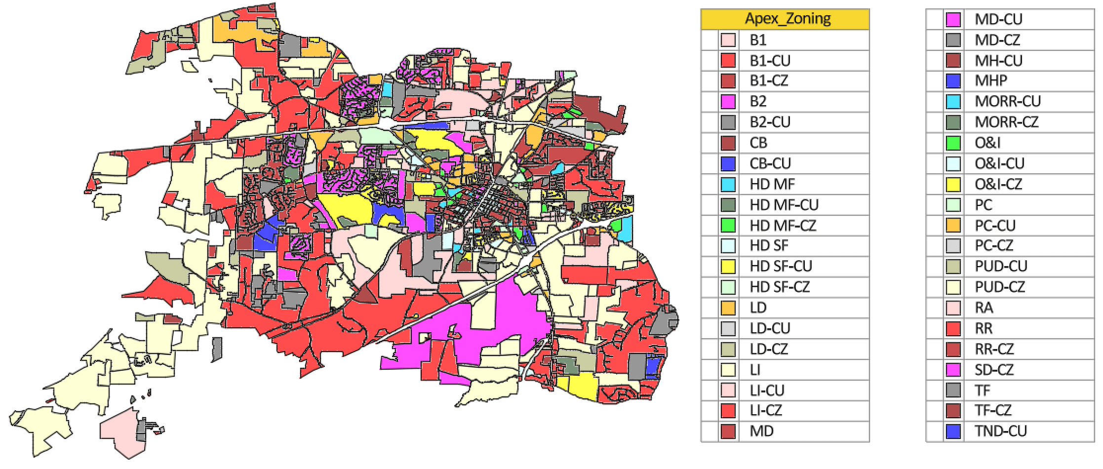
Users can stylize features to highlights data as needed, see how the Town of Apex Zoning areas are color coded.
THE ISSUE: how to save and share configured look.
While looking at Display Manager or the Style Editor palettes, initially the there is NO apparent way to save or export the stylized look of feature data to recreate in another drawing or future connections. 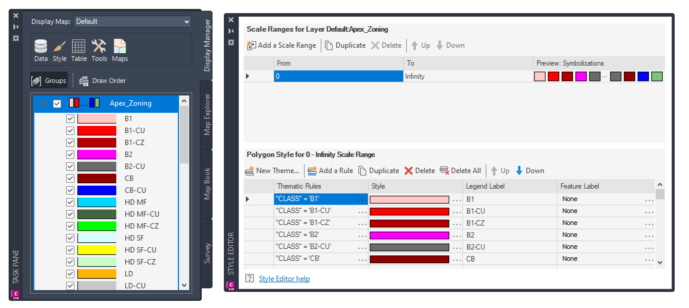
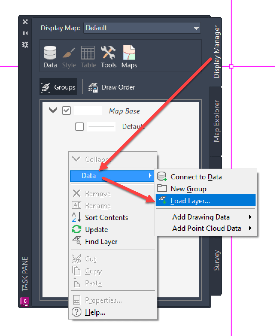
THE SOLUTION: Save and Load “Layers”
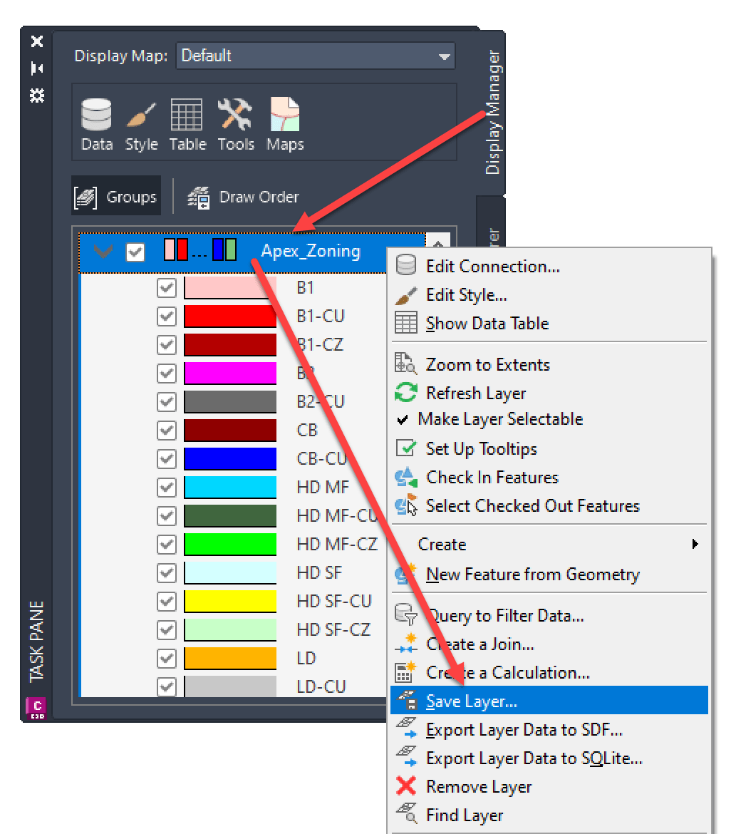
First, from the Display Manager tab > right click on connection (Apex_Zoning in this example) > select Save Layer… > browse to and save file.
Then, in a new drawing a connection can be created from the Display Manager > right click in blank area > select Load Layer… > browse previously saved file.
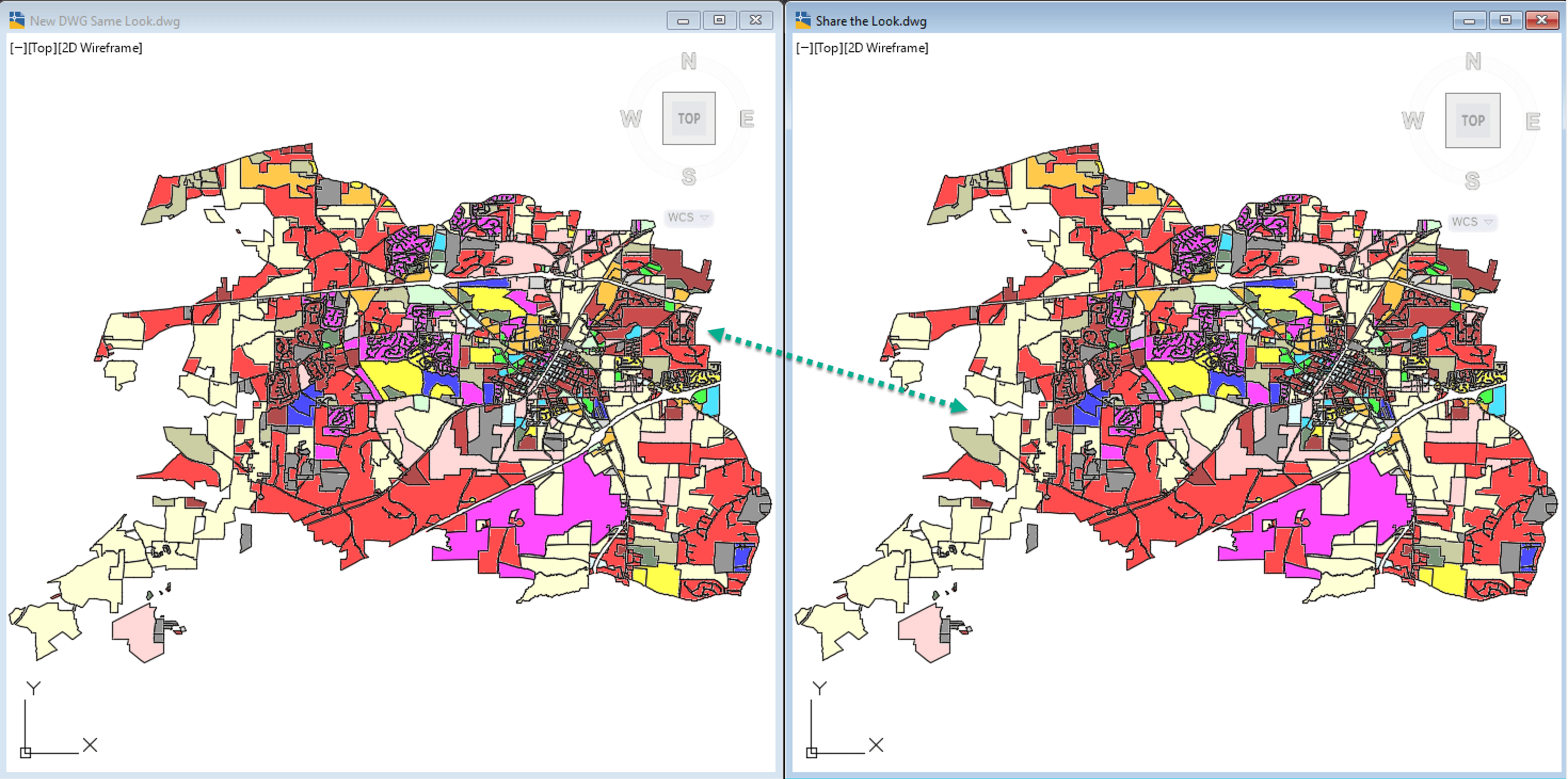
Comparing the starting drawing to the new drawing (shown below) the connection to the feature data is created and the look is duplicated all in ONE step:
Hope you have enjoyed this simple write up, if you are interested in learning more we offer training courses on Map 3D:
• AutoCAD Map 3D: Essentials
• AutoCAD Map 3D for Autodesk Civil 3D Users
If you are interested in more in-depth training or mentoring the IMAGINiT team can help you!
About the Author
More Content by Leo Lavayen


