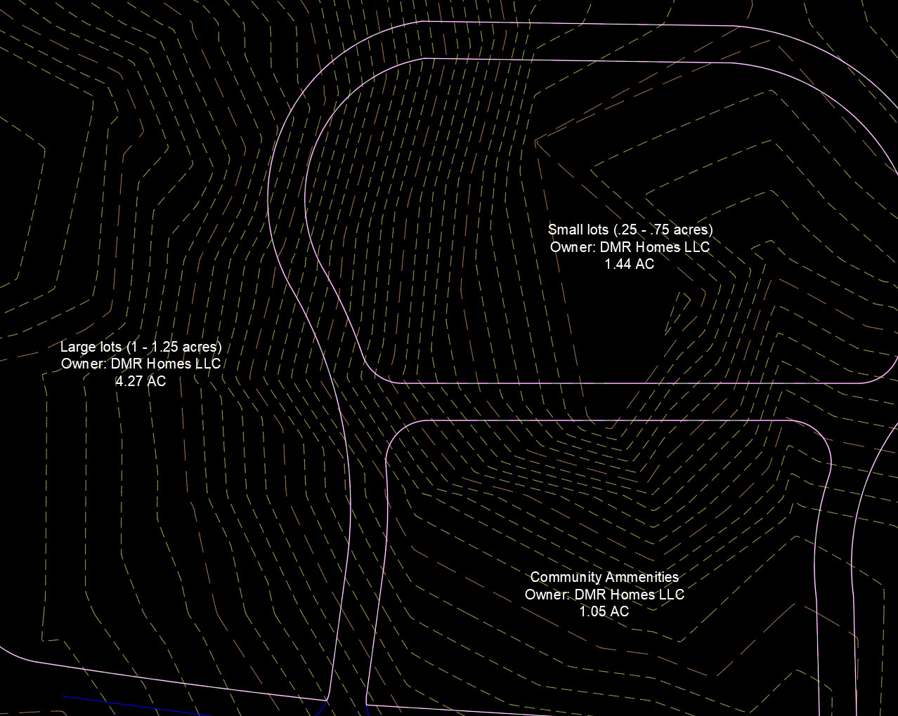
Parcel labels can be set up to show property owner names and, quite frankly, any information you deem importan. The labels shown below contain property owner and parcel usage information.

 Parcels are intelligent polygons and can store information.
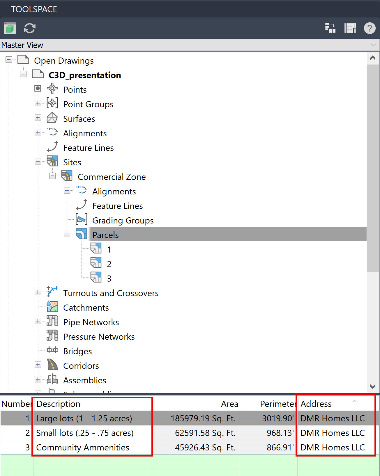
Selecting Parcels in the Toolspace opens up several columns that contain both generated and manually entered information. Area and Perimeter are automatically generated. The Description and Address columns are open for manual text entry by the user.
This is where the outside-of-the-box thinking comes into play. The Description column can be anything. Zoning code, soil type, owner information, market value, anything that you determine is important enough to store in the Parcel. The Address column, despite its name, can also contain any information that you manually type into it.
In this scenario, I used the Description and Address columns to list important information for a future home development in its early planning stage. Current owner, in this case the developer, is listed in the Address column. Once the parcels are sub-divided and street addresses are assigned, I can swap out the information.
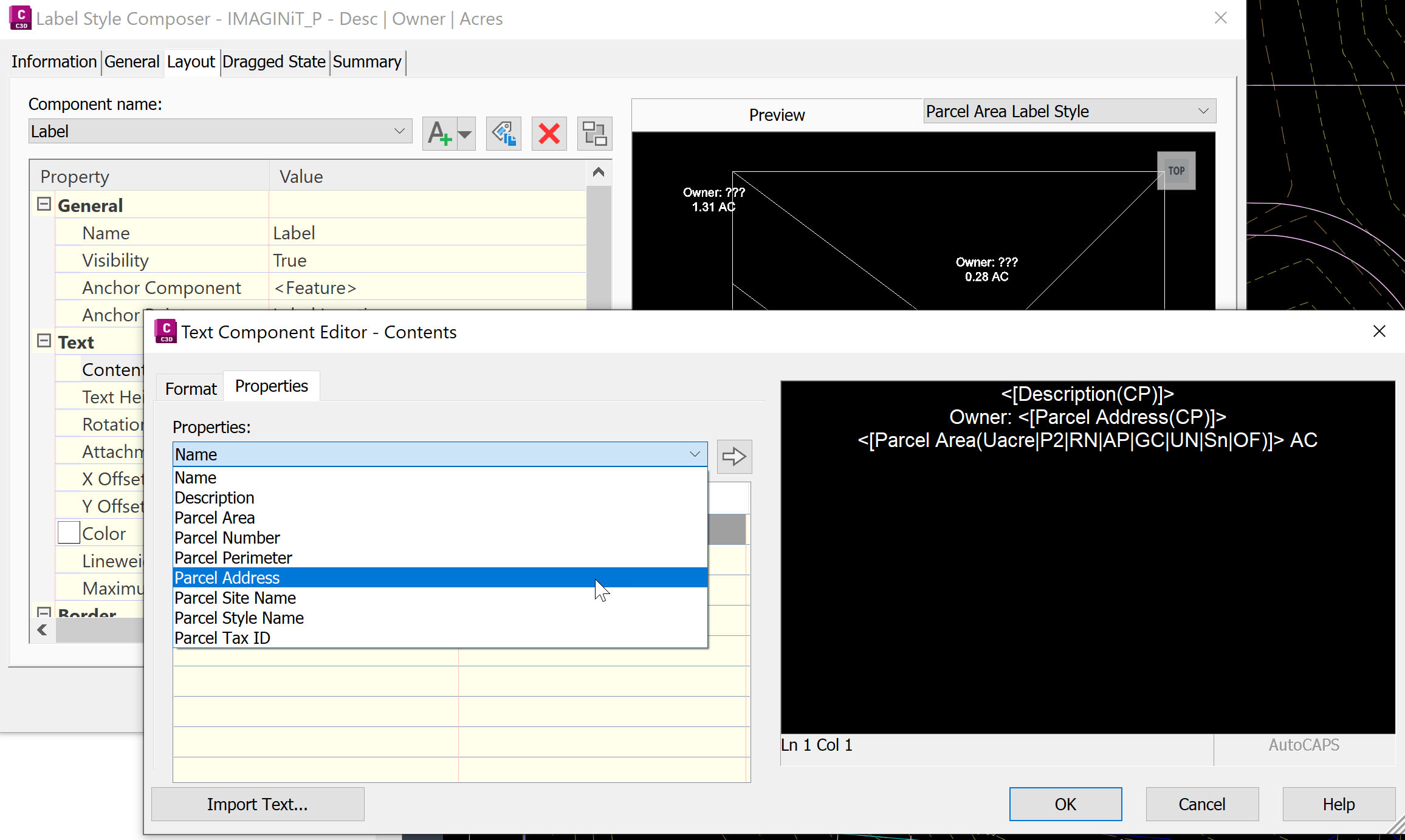
Information stored in Parcels can be shown in labels. Civil 3D object labels contain many options and for an in-depth teaching on this subject reach out to IMAGINiT to enquire about our Civil 3D Beyond the Basics course.

About the Author
Follow on Linkedin More Content by Dana Rice


