

Do you need COGO Points need to reference alignment location information?
There are several ways to associate COGO Points with alignment station and offset data in Civil 3D.
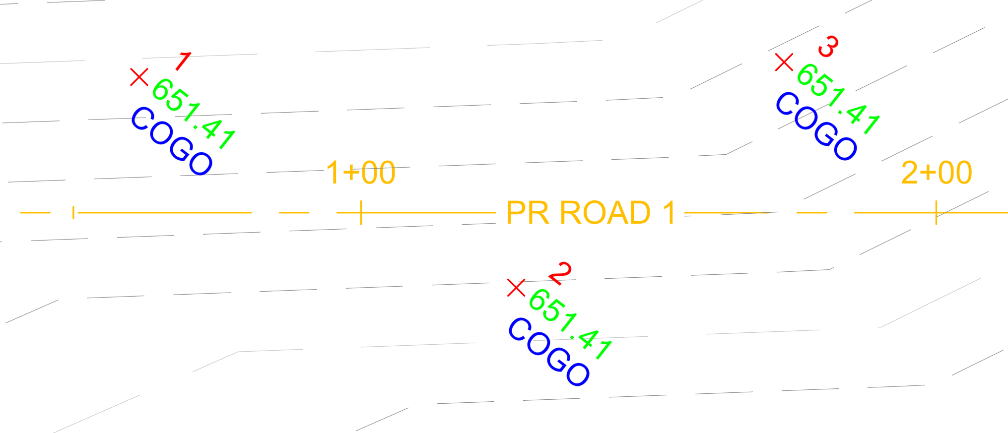
Let's explore a few options, from native functionality to enhanced tools.
Option 1: Alignment Labels
The simplest option is to create a Station Offset labels on top of the COGO Points. 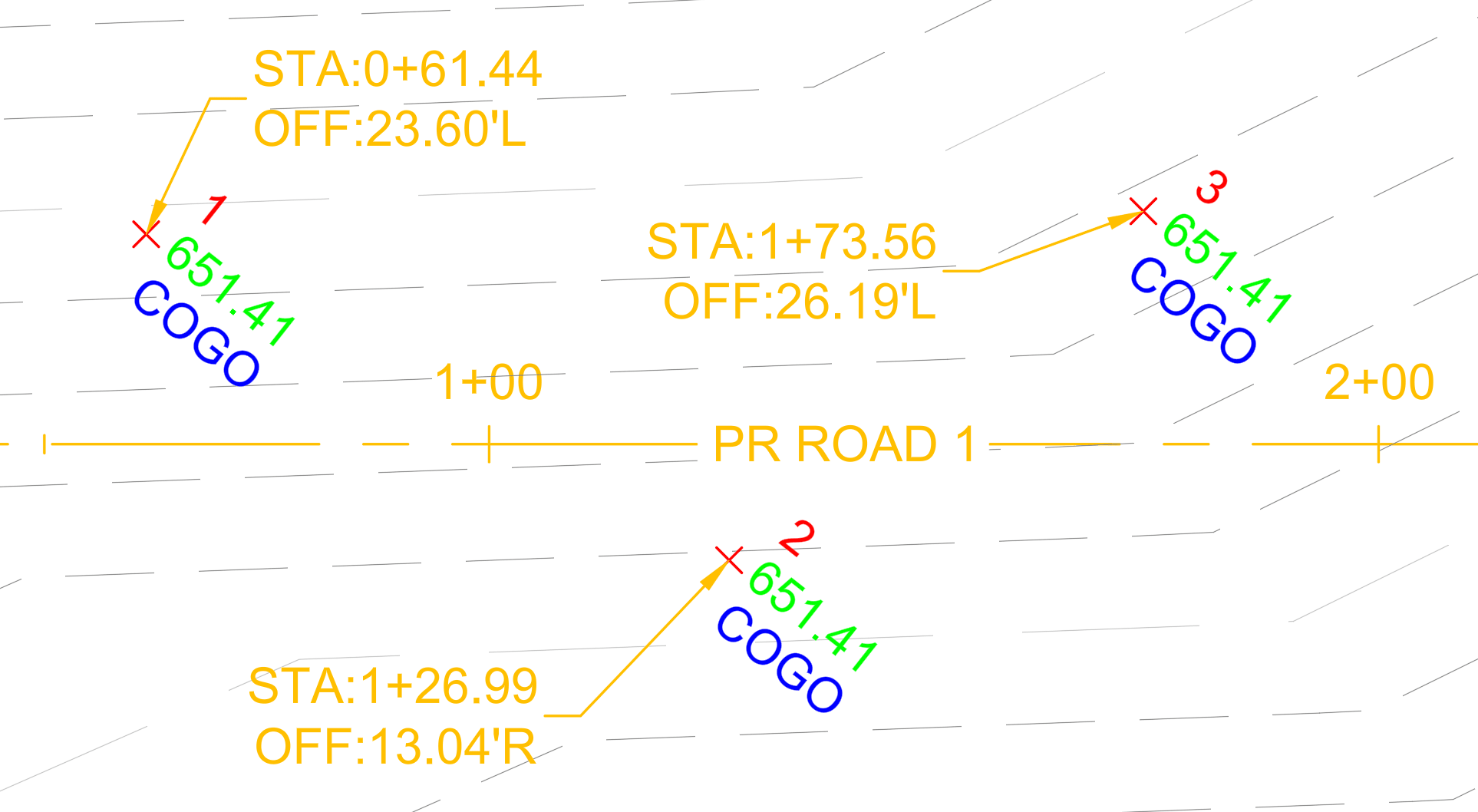
This is a simple, direct, manual solution. However, it creates additional labels in the drawing, which can lead to overlapping or duplicate annotation.
Option 2: Toolbox Report
Civil 3D includes built-in reporting functionality through Toolspace. One available report from the Toolbox tab is the Station Offset to Points report.
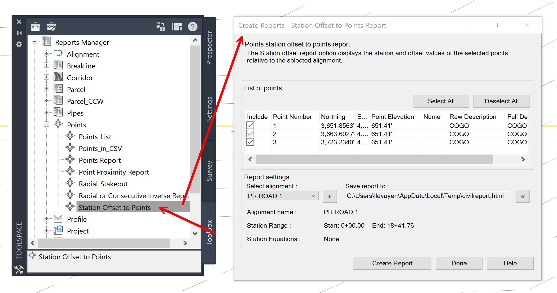
From the Create Reports – Station Offsets to Point Report dialog box, select the points to include in the report. Civil 3D then generates an external report containing the corresponding station and offset information for each selected point.
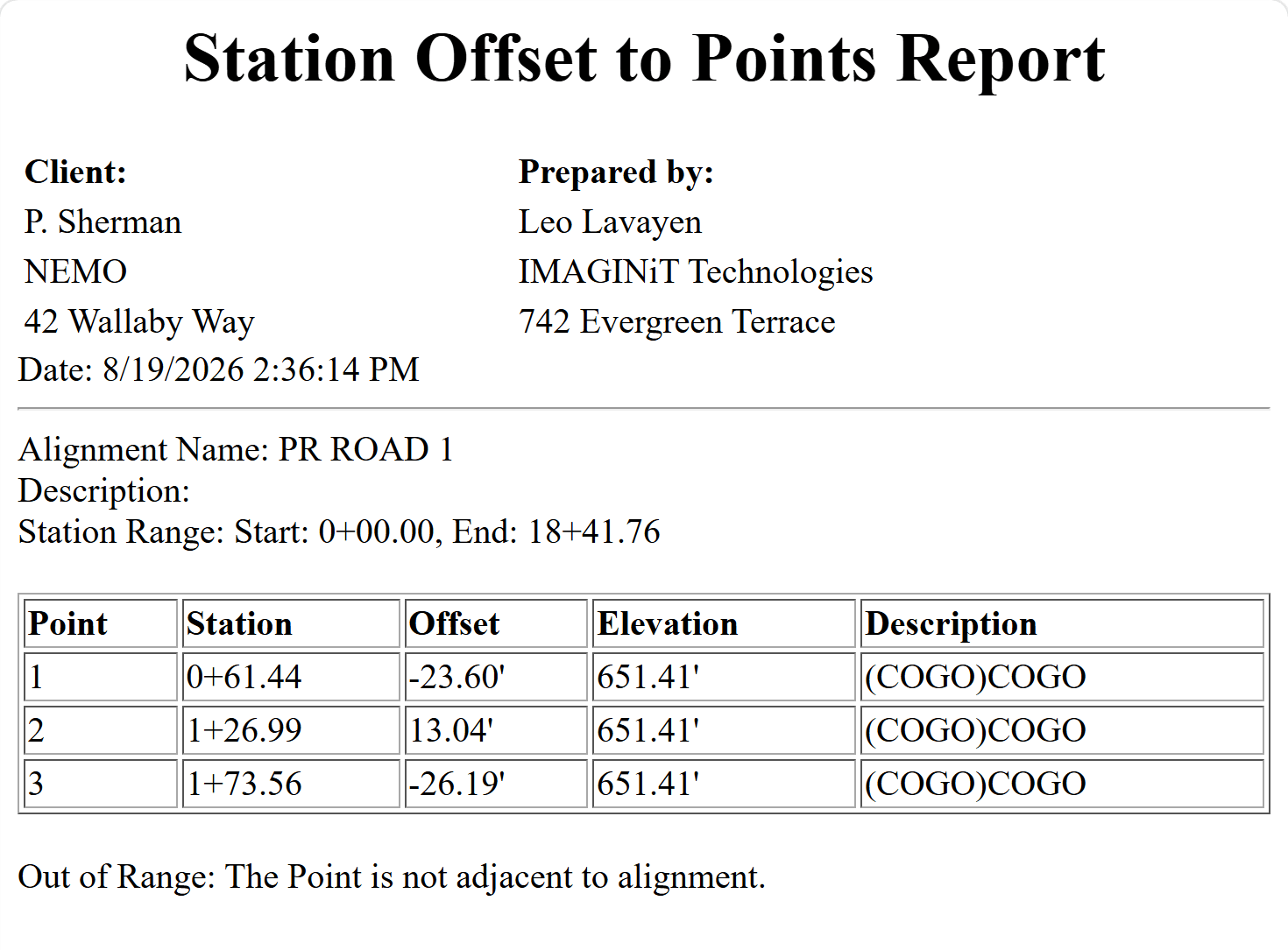
A simple automated solution. However, because the report is external to Civil 3D, it is static. If either the points or the alignment are modified, the report must be regenerated.
Option 3: Project Explorer
Another option is to leverage Project Explorer, which was added to Civil 3D several releases ago. In the latest release, it can be accessed from: Home tab → Explore panel → Project Explorer command. 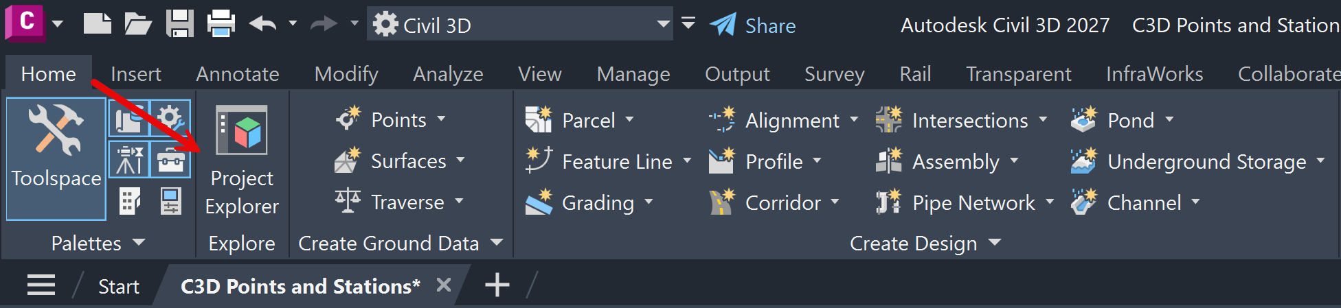
This opens the modeless Project Explorer window. From the Points tab → in the selection row click on the Compare To fly out → select Alignments, then choose the desired alignment. The comparison columns populate automatically, displaying the corresponding station and offset values for each point. 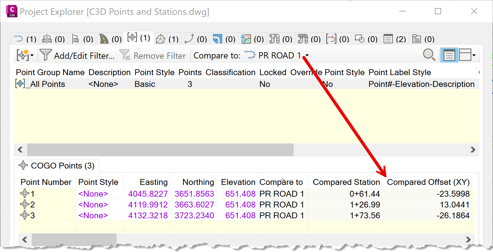
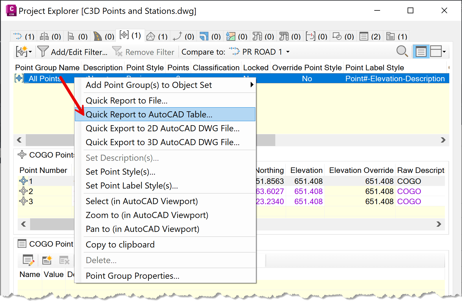
You can take this one step further by creating an AutoCAD table directly in the drawing. Right-click the desired Point Group in the Project Explorer tree → selct Create Quick Report to AutoCAD Table.
The resulting table(s) can be customized to display only the data columns you need.
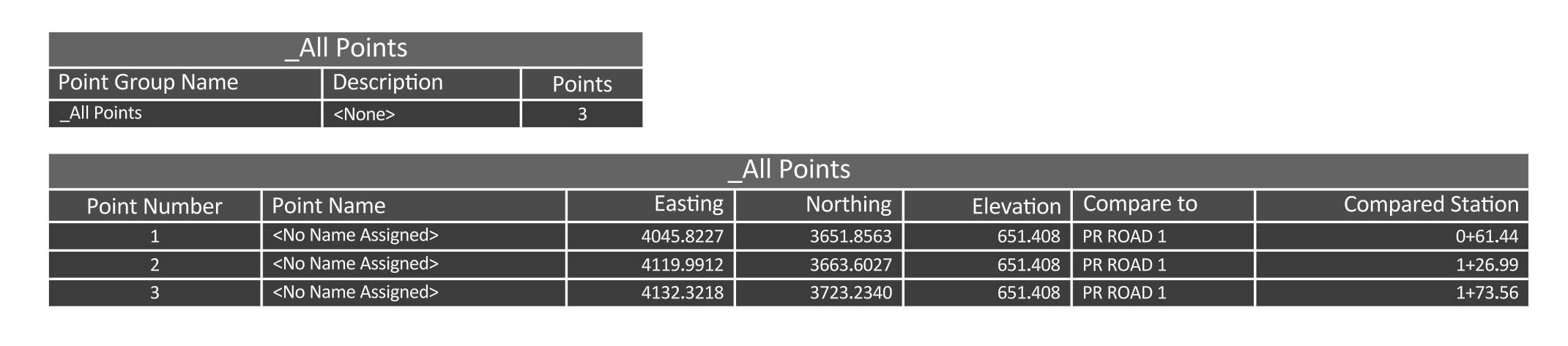
This is a more advanced solution that still relies entirely on native Civil 3D functionality.
If you'd like to learn more about Project Explorer, our own Brian Johnson has written a blog series:
- Paroject Explorer - Part-1
- Managing Objects - Part 2
- Reports - Part 3
- Tables & 2D drawings - Part-4
- Object Sets - Part-5
Option 4: Custom added functionality – IMAGINiT Tools
IMAGINiT develops a suite of productivity tools, updated yearly, that integrate directly with Civil 3D. One of these is the Point Station Report tool. Access it from the ribbon IMAGINiT tab → Points panel → Point Station Report commnad.

The dialog box provides multiple methods for selecting points and choosing the comparison alignment, either from a drop-down list or directly from the drawing.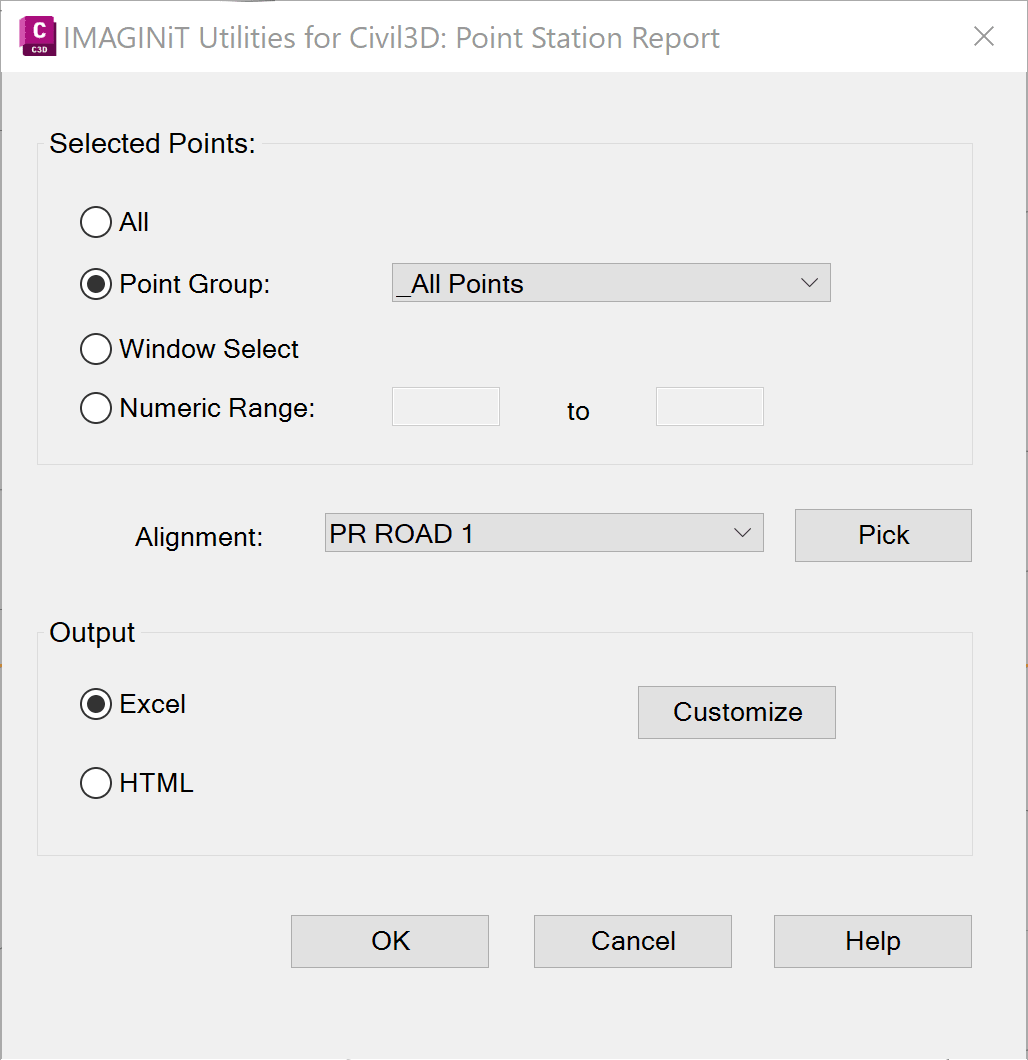
The report can be exported to Excel or HTML. Users can also customize exactly which data fields are included in the output.
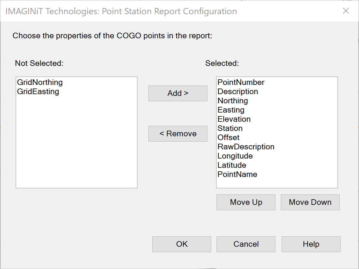
Once the desired elements are selected, the report is generated. An example of the Excel output is shown below.
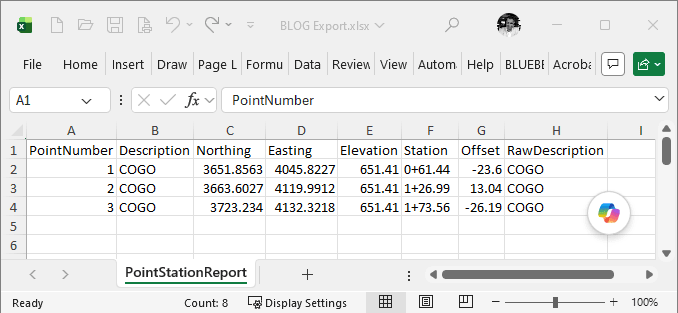
Again, as the report is external to Civil 3D, it is static. If either the points or the alignment are modified, the report must be regenerated. Unlike the previous options, this functionality is not included with the standard Civil 3D installation.
To learn more about IMAGINiT Utilities for Civil 3D, visit:
Civil 3D provides several native methods for associating COGO Points with Alignment station and offset information. Depending on your workflow, simple labels, built-in reports, or Project Explorer may provide everything you need.
For organizations that require greater flexibility and more efficient reporting, IMAGINiT Tools extend Civil 3D with additional capabilities that streamline the process and reduce repetitive work.
About the Author
More Content by Leo Lavayen


