
If you’ve used Autodesk Map 3D over the years, you may remember a panel that helped create multiline labels for Feature Data Objects (FDOs). I used it recently and realized—it doesn’t work the way it used to.
The Issue
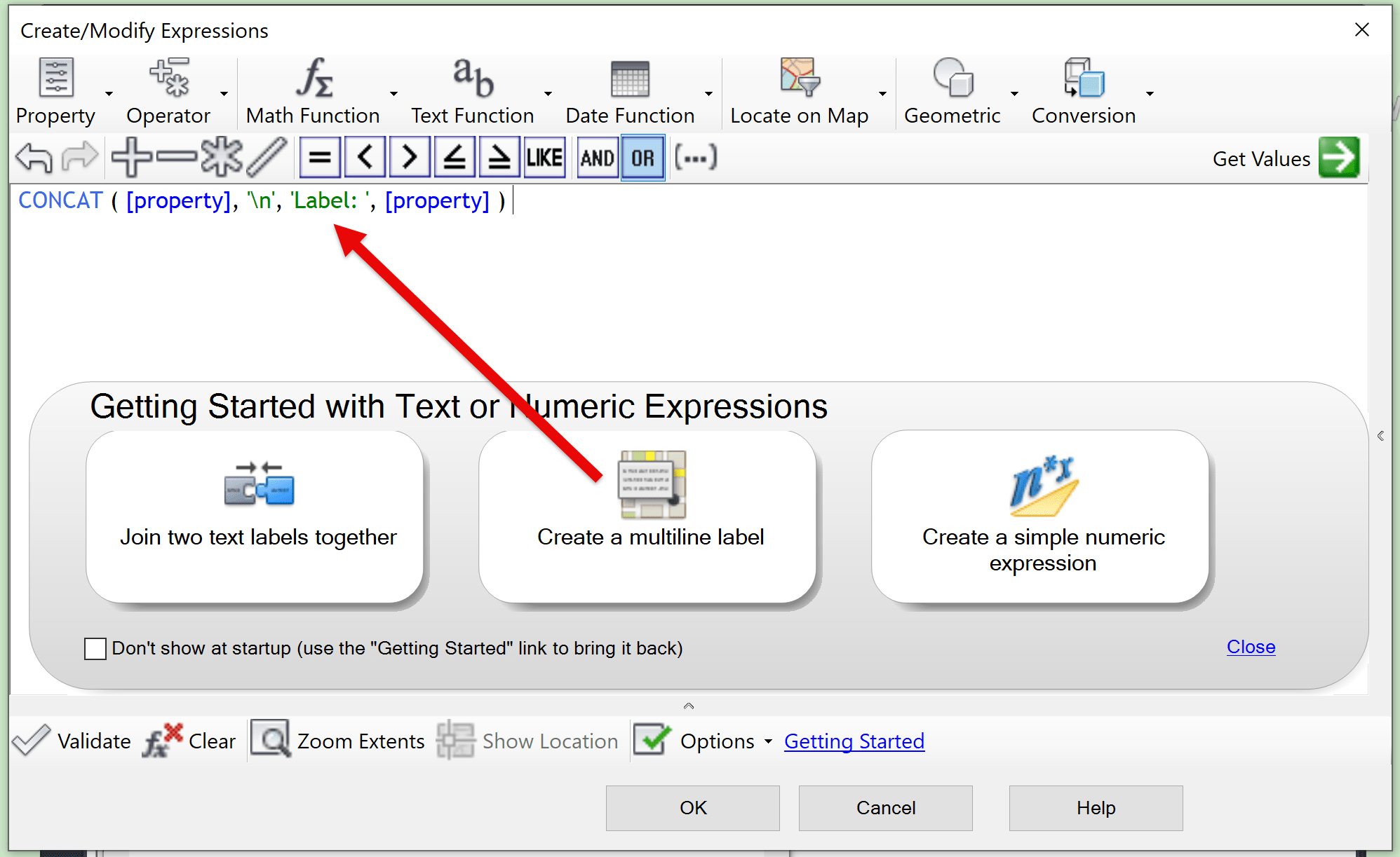
When you go to the Feature’s Style Label dialog box and select the Getting Started option at the bottom, you’ll see a sample called Create a multiline label.
This sample uses the `CONCAT` function to combine multiple properties, along with the `\n` character to insert line breaks. In this example, a label show both the Property ID Number and the Address Number like this:
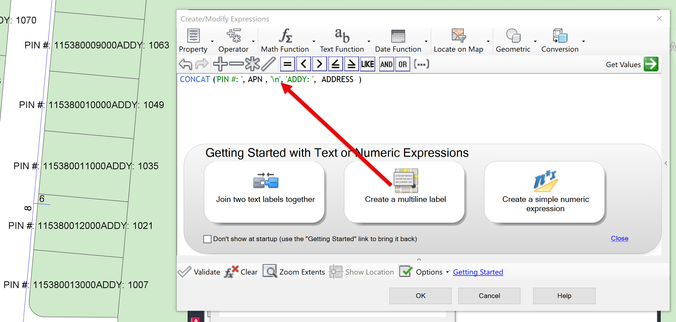
However, when used, the `\n` is ignored—so the label displays everything as a single line, not as separate stacked lines.
The Solution
While digging through the Autodesk help docs, I found this helpful note:
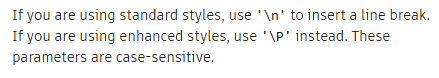
Made the simple swtich form `\n` with `\P` - Like this:
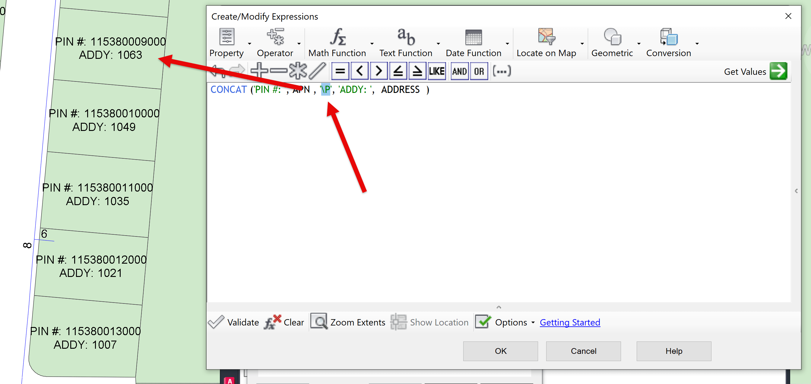
This correctly inserts a line break, and your label now stacks the values as expected!
Want to Learn More?
If you found this helpful, check out some of our other Map 3D posts:
- Map 3D: Sharing the Look of Stylized Connections
- Connected Map 3D Data Not Geolocating Correctly
- Map 3D: When Using MAPIINSERT No World File is Found
For more in-depth training or mentoring, the IMAGINiT team is here to help.
About the Author
More Content by Leo Lavayen


