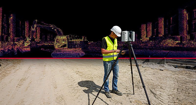
There is a lot of buzz right now over a software product that Leica has released known as Cyclone 3DR. Many people out there are referring to Cyclone 3DR as a new product from Leica. However, there are also many out there referring to the same software package as 3DReshaper. For those not in the know, they might think these are two different packages and maybe even competitors. The truth is, 3DR is kind of both a new software package and one that has been around for a while. Cyclone 3DR was formerly known as 3DReshaper. You see, it was a product created and owned by a company named Technodigit until it was purchased by Hexagon (Leica’s parent company) and branded as Cyclone 3DR.
Now that we have that straight, let’s get into what the software is and what it can do. When I was first introduced to 3DR (3DReshaper at the time), I thought it was just for people who wanted to recreate statues or model items for a media and entertainment software like Maya or 3DS Max. I quickly learned that is not the case. 3DR is a product that can be used by many different disciplines for many different tasks. For instance, would you think a software that can turn this:
into this:
And with very little effort we can do so much more.
Let’s investigate the other tasks Cyclone 3DR can handle. If you are a surveyor and are looking to accomplish creating a DTM quickly and efficiently, there are several tools in 3DR that might interest you. One example of those tools is that when we scan a civil/survey site like a road or trail, we often run into massive amounts of data that are of no use to use like tall grass and trees. Using commands like DTM Smart Modeling allow us to quickly and efficiently ignore this data and create a surface model based on the lowest points of a point cloud. The image below is from the 3DR Help menu showing how the DTM Smart Modeling tool will clean a noisy point cloud.
Maybe you’re not looking to create the DTM directly but want a tool that will assist with the creation of the DTM in another software. 3DR has that capability as well. 3DR provides functionality to create customized scripts that can use commands in the software to extract data from a point cloud. In the images below, we see a point cloud where a very short piece of curbing has been traced using the polyline command. Using this small amount of data, we can run a script that comes with the software package to extract curbing.
After running the script, the macro begins to run extracting curb based on both the point cloud and parameters entered by the user.
In little time, the script, creates linework if there is enough data to support the linework it is trying to create.
Cyclone 3DR supports other disciplines as well. For those in the architectural industry, there are tools to assist in the creation of modeling buildings. The software will analyze a point cloud and extract planes to represent walls or stairs. This process is fairly simple process where we break down the point cloud into rooms so we can easily see the room we would like to model. To do this a Limit Box is created and adjusted to see the area of interest.
Using the Building Extractor tools, select a few planes on the point cloud to create the walls.
So, as you can see there are many tools to assist us with different tasks in Cyclone 3DR. The last item I would like to mention about the tools available in the software is that we can do various types of analysis using this powerful software. A few examples are creating a heat map and detailed report for floor flatness, levelness and slope analysis. All of this while creating on screen labels to show various important areas of our project. Another example would be to use the software to compare a point cloud to a CAD model and show the areas where they differ. This can be done where a project has a designed model and is scanned throughout the construction process to see if it meets the design tolerances or if it is being built incorrectly and something needs fixed before the project is completed. There are many tools that I have not mentioned in this post. Some of these items were covered in a webcast IMAGINiT presented in February of 2020. I have provided the link to that webcast below.
IMAGINiT 3DR Webcast:
https://resources.imaginit.com/reality-capture/the-reimangined-cyclone-3dr
About the Author
Follow on Linkedin More Content by Jay Meszar


