
Welcome back to the third blog in my series on IMAGINiT’s Utilities for Revit. Today, I am excited explore an exciting site visualization tool within our Utilities for Revit called Earth Connector. This tool significantly enhances the way we visualize and present Revit models by integrating with Google Earth Pro, providing functionalities that are not available out-of-the-box in Revit.
What is Earth Connector?
Earth Connector is a utility developed by IMAGINiT that allows Revit users to export their models as .KMZ files. KMZ files are a format used by Google Earth for displaying geographic data. This capability is particularly valuable for architects, engineers, and planners who need to present their projects within the context of their real-world geographic locations.
Key Features of Earth Connector
1. Export Revit Models to Google Earth Pro:
- Earth Connector allows users to take their 3D Revit models and export them directly into Google Earth Pro. This feature is a game-changer for presenting models in a more intuitive and accessible platform.
2. Visualization of Revit Phases:
- One of the standout features of Earth Connector is its ability to integrate with Google Earth’s timeline feature. This allows users to view different phases of their Revit project over time, providing a dynamic way to visualize the progress and development of a project.
3. Contextual Site Visualization:
- By exporting Revit models to Google Earth, users can see their projects in relation to the surrounding environment. This includes existing buildings, topography, infrastructure, and other geographic features. It’s an excellent way to evaluate the impact of a project on its surroundings and to communicate this to stakeholders.
4. Enhanced Presentation and Communication:
- Earth Connector makes it easier to share and present models. Stakeholders can view the project in Google Earth, which is a widely accessible platform, without needing specialized Revit software or knowledge. This accessibility enhances communication and collaboration across project teams and with clients.
How to Use Earth Connector
Here’s a step-by-step guide to using Earth Connector:
1. Install IMAGINiT’s Utilities for Revit:
- Ensure that you have IMAGINiT’s Utilities for Revit installed. You may need to download it from the IMAGINiT website or from your company's software library.
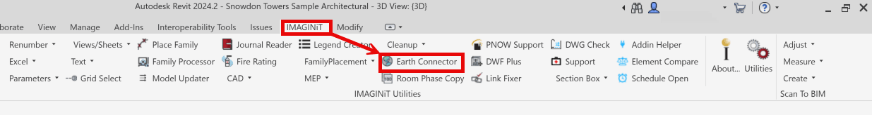
Once installed, the IMAGINiT Utilities for Revit will appear in the Ribbon under the ‘IMAGINiT’ tab.
![]()
2. Prepare Your Revit Model:
- Make sure your Revit model is ready for export. This includes verifying that the model’s location data is accurate and that the model elements are correctly set up for the export process.
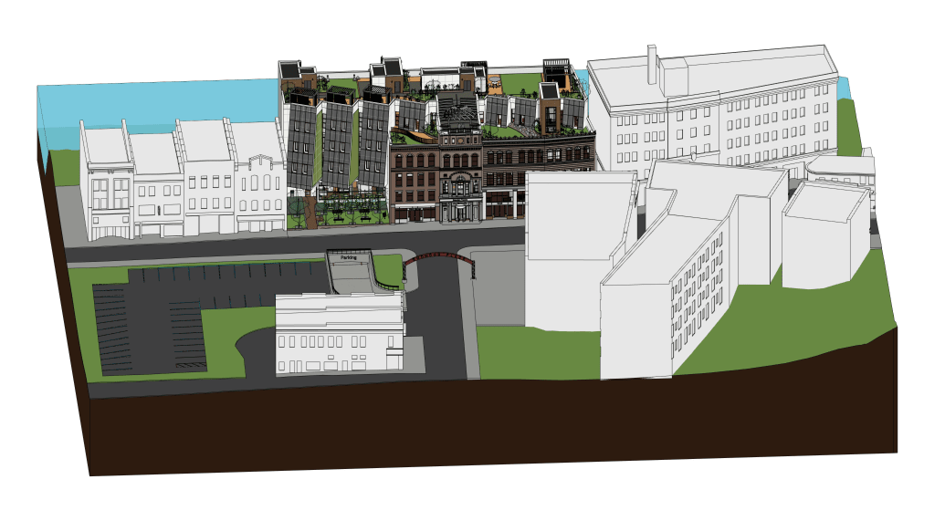
The ‘Snowdon Towers’ sample project as shown in Revit 2024.
Ensure that the project’s location information is correct prior to exporting.
3. Export to KMZ:
- Use the Earth Connector utility to export your Revit model as a .KMZ file. This involves selecting the elements you want to export and configuring any necessary settings, such as the level of detail and the phases you wish to include.
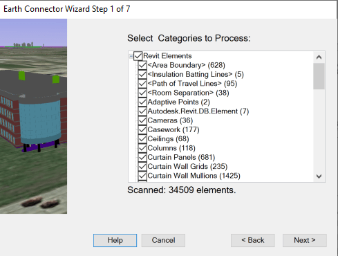
Select what element categories to include in the export.
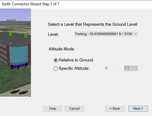
Select what level you wish to set as the base level of the model in the KMZ file.
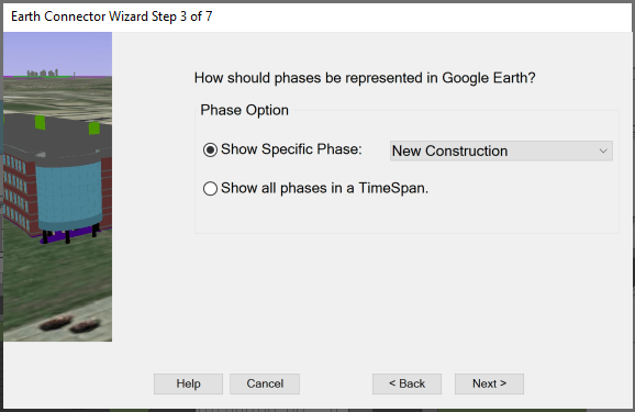
You can set if you want to show only a specific phase of the model OR if you want to show all phases via the timeline in Google Earth Pro.
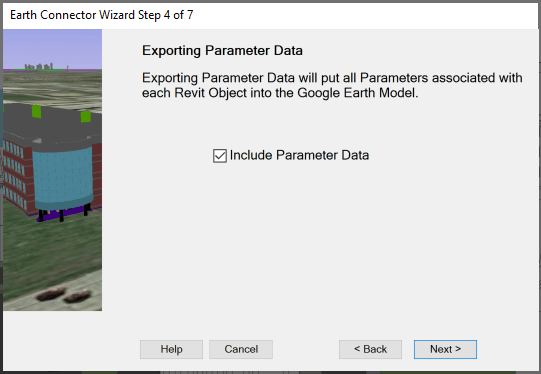
You can also include parameter data within the export.
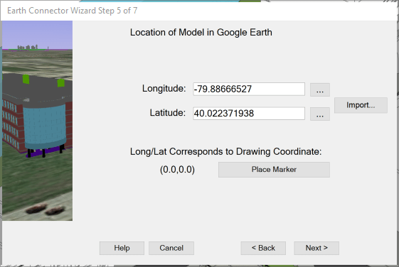
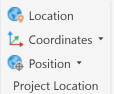
After selecting if you want to add in parameter data or not, you are prompted to set the longitude and latitude coordinates. You may set this by importing a KML file from Google Earth as well.
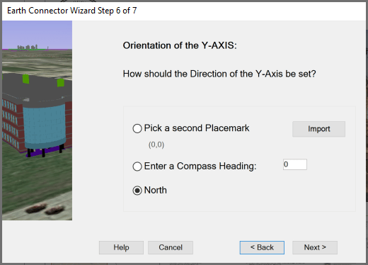
After setting the longitude and latitude, set the orientation of the Y-Axis by either a second placemark, a compass heading, or using Project North.
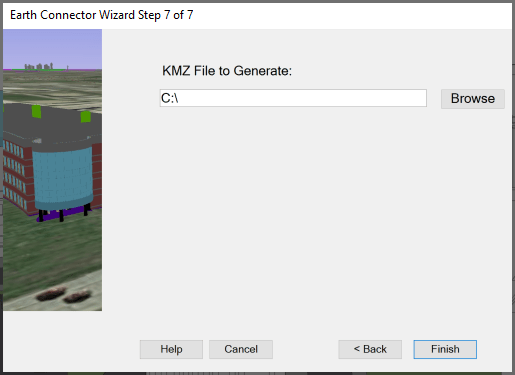
Then, lastly set the save location for the KMZ file.
4. Open in Google Earth Pro:
- Open Google Earth Pro
 and import the .KMZ file. Your Revit model will be displayed in the geographic context you’ve specified, allowing you to explore and present your project in 3D.
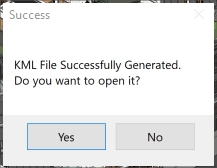
Once the KML file is ready, the Earth Connector utility will prompt you to open the file automatically in Google Earth Pro.
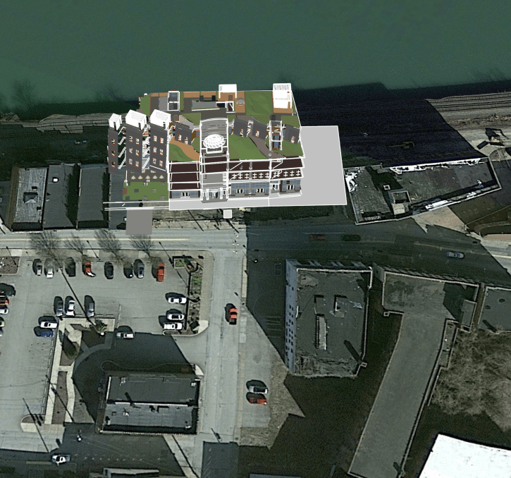
The model as displayed in Google Earth Pro.
5. Utilize Google Earth’s Timeline Feature:
- To visualize the different phases of your project, use Google Earth’s timeline feature. This allows you to see how your project evolves over time, offering a dynamic view of its development stages.
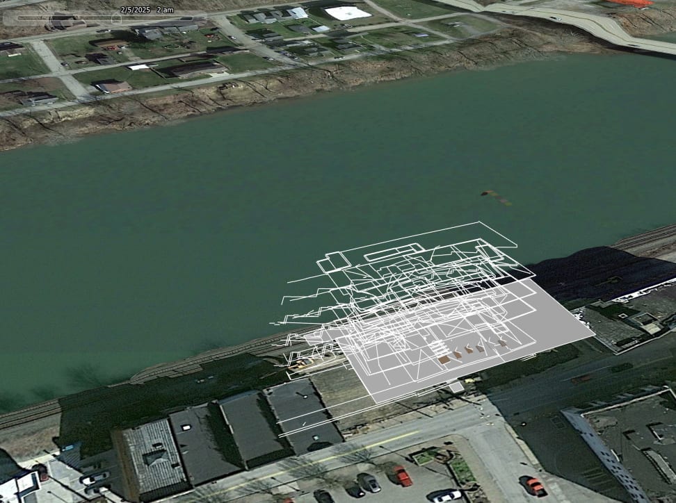
Google Earth Pro showing Revit Phases through the Timeline feature.
Benefits of Using Earth Connector
· Improved Visualization:
- Seeing your Revit model in Google Earth provides a more comprehensive understanding of how the project fits into its actual location.
· Better Communication:
- Presenting your project in Google Earth makes it easier to share with non-Revit users, including clients, stakeholders, and the general public.
· Enhanced Planning and Analysis:
- By visualizing the project in its real-world context, you can better assess factors such as shadow analysis, sight lines, and environmental impact.
Earth Connector is an invaluable tool for anyone looking to enhance their Revit workflow by integrating with Google Earth Pro. Its ability to export models as .KMZ files and utilize Google Earth’s timeline feature provides a new dimension of site visualization and project presentation. This utility not only streamlines the process of contextualizing Revit models but also significantly improves communication and collaboration across all project stages.
Stay tuned for the next blog in this series, where we will continue to explore more innovative tools and utilities from IMAGINiT’s Utilities for Revit that can enhance your Revit experience!
About the Author
Follow on Linkedin More Content by Scott Green


